Skip to content
tern header logo
Latest - March 17, 2025 Tern featured in Forbes: AI-Based GPS Without Satellites | The Future Of Navigation
Pilot our technology today
Applications
  • Automotive
    Automotive
  • Fleets
    Fleets
  • Government
    Government
Tern.AI IDPS replaces GPS

Care for a test drive?

The best way to see how well IDPS™ works is to try it yourself.

Please enable JavaScript in your browser to complete this form.
Please provide a business email.
Rectangle 125

For years, we’ve looked to space for information on where we are and where to go next.

Like compasses, maps, and printed-out directions, using satellites to power turn-by-turn navigation was another evolutionary leap in humans’ long history of finding our way around.

And, for years, GPS has worked as it was designed…

Unless you’re…

driving out of a tunnel and your GPS can’t decide which way you need to turn.

in an urban maze of criss-crossing roadways.

in a dead zone.

driving on a highway with multi-level roads.

Rectangle 138
Rectangle 124
Rectangle 124
Rectangle 124 (1)
Why_3

On top of these everyday frustrations, satellites are a single source of failure, susceptible to interference and jamming. A one-day GPS failure costs upwards of $1 billion, and puts our entire infrastructure at risk.

Rectangle 125 (2)

We’ve accepted the minor and major inconveniences that come with satellites because it was the best navigation solution available. Not anymore.

It’s time to bring positioning and navigation…

Space
Road

Back down to Earth.

It’s time for Tern.
The next evolution in wayfinding.

Tern is a positioning and navigation software that powers reliable turn-by-turn directions without satellites, offering a safer, smoother, and more reliable way to get where you’re going.

What makes Tern different?

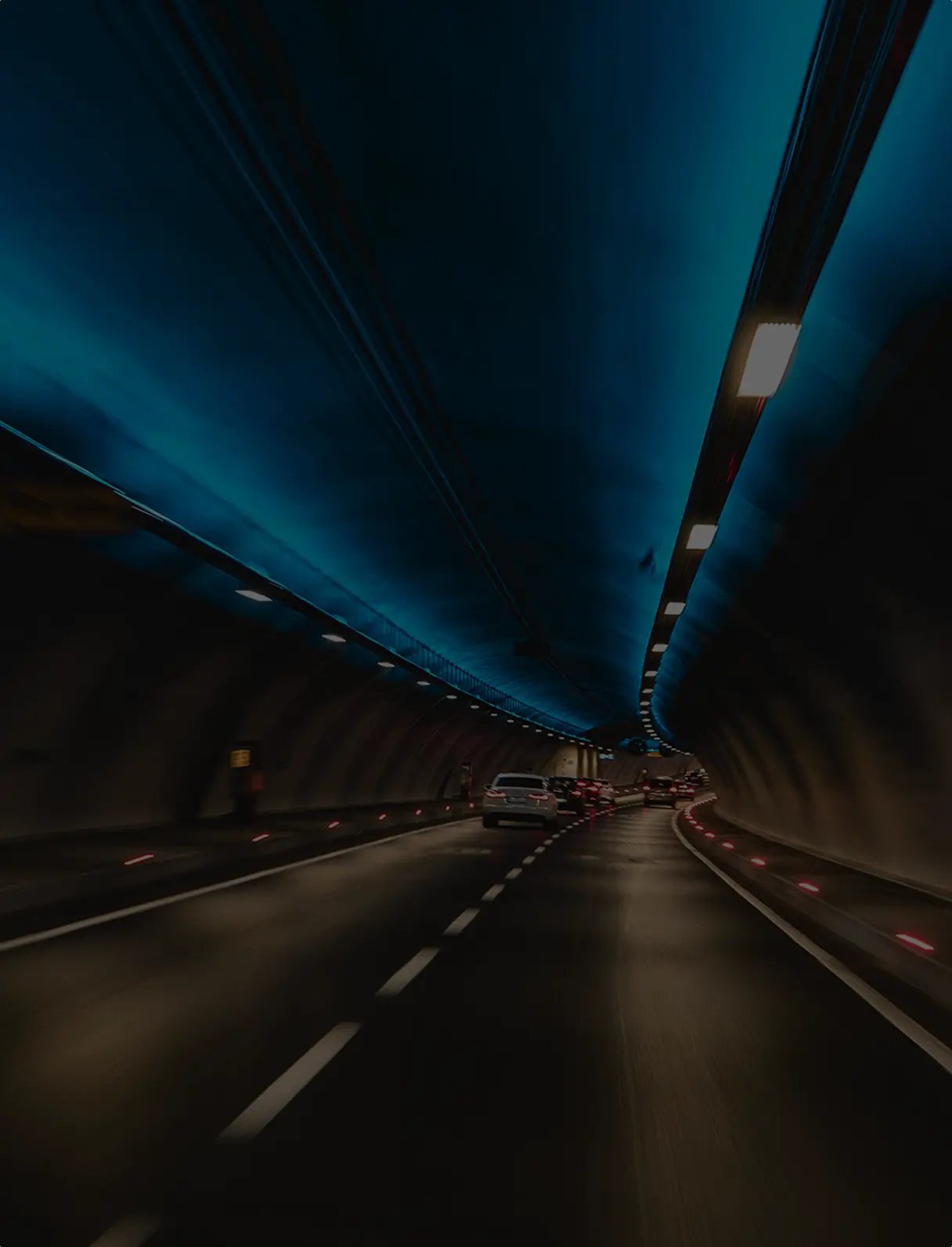
Signal-free navigation

Bad weather. Remote locations. Tunnels. Parking garages. Road obstructions. Solar flares. Tern continues navigating through the conditions that typically weaken or diminish signal and leave us stranded. IDPS™ is also the first and only alternative to GPS on the market that can self-initialize as soon as you start driving, without needing to triangulate your location.
Rectangle 134

Smooth rides

We’ve tested IDPS™ over tens of thousands of miles—it’s the only provider of unlimited continuity in complex environments on the market. It’s also accurate to less than four meters, making it more precise than the average for both GPS-enabled smartphones and dead reckoning.
Rectangle 134 (1)

Cost-saving

Hardware, like a satellite, is expensive. Tern is a one-time purchase, requires no infrastructural adjustments to cars or devices, and can be updated hands-free for years into the future.
Rectangle 134

National security

Foreign interference with GPS signals has increased dramatically. Two increasingly potent threats to national security are spoofing, sending false GPS signals to disrupt navigation systems, and jamming, disrupting the GPS signal altogether. IDPS™ provides an accurate, self-contained alternative to GPS, eliminating our dependence.
Rectangle 134 (2)

Personal privacy

When your phone or car is constantly receiving signals from satellites in space, tracking your location is just a matter of processing those signals—and it isn’t hard to do. But almost all modern location service providers capture and monetize their users’ locations by collecting data from their devices. With IDPS™, you don’t have to receive—or send—long-distance signals. That means you know where you are, without worrying that others do too.
Rectangle 134 (3)
Car interior sunset
Fleets in Parking
Fire Truck

Explore our applications

Tern powers a smooth, safe drive from point A to point B, and all the pit stops in between. IDPS™ works with vehicles’ existing base maps and sensors, improving navigation and location services that help users find food, rides, weather info, and first dates.

Automotive applications

No matter how far off the grid professional drivers need to travel for package delivery, emergency response, or cross-country transportation, Tern can get them there.

Fleet applications

Tern ensures positioning, navigation, and timing (PNT) information is available even when traditional communications networks are down, and is more secure than satellite-geolocation when it comes to jamming, spoofing, and hacking—all known threats to privacy and national security.

Governmental applications
Tern.AI IDPS replaces GPS

Care for a test drive?

The best way to see how well IDPS™ works is to try it yourself.

Please enable JavaScript in your browser to complete this form.
Please provide a business email.